Brick Street Cemetery – Digital Exhibit
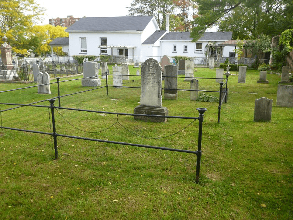
Between 2012 and 2015, Timmins Martelle Heritage Consultants Inc. (TMHC) completed four geophysical surveys of the Brick Street Cemetery in London, Ontario. Non-intrusive Ground Penetrating Radar (GPR) surveys were conducted over several small areas containing both known and potential burials on the cemetery grounds.
Brick Street Cemetery is one of the oldest in London with interments dating from 1813. In 1994, the cemetery was designated a provincial heritage site. Stewardship and restoration of the cemetery, as well as genealogical research on associated families has been undertaken by the Friends of Brick Street Cemetery (FBSC). The FBSC has established that there are at least 70 individuals buried in the cemetery for which there are no extant markers. In order to locate these missing markers and delineate the burials themselves, the FBSC enlisted the geophysical services of TMHC.
Brick Street Cemetery – Previous Archaeology
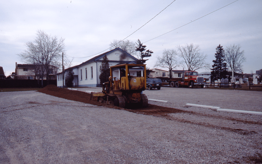
TMHC’s work at the cemetery is not the first time archaeologists have visited the property. In 1989, archaeologists from what is now the Museum of Ontario Archaeology were contracted to look for potential unmarked graves under the eastern portion of the Brick Street Church’s parking lot.
In designating the church (built in 1852) as a heritage property, the City of London’s Local Architectural Conservation Advisory Committee (LACAC) noted that many graves predated the construction of the church (as recorded by the Brick Street Cemetery Restoration Committee in 1984). It was thought that an earlier church and possibly more graves could be located in the parking lot area, necessitating the archaeological survey. Using a small bulldozer, up to 60 cm of gravel fill was removed revealing the subsoil beneath.
While no graves were found, the 1989 project demonstrates the invasive nature of ground-altering fieldwork in a cemetery or suspected cemetery context.
What is Ground Penetrating Archaeology (GPR)?
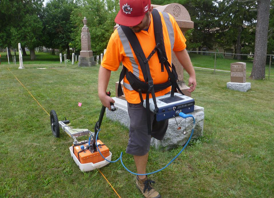
Ground Penetrating Radar (GPR) is a remote sensing technique which employs radio waves to map natural and man-made structures or features buried in the ground. Radio waves are emitted into the ground and reflected when objects or different types and densities of materials are encountered within the soil. This data is saved on an onboard computer and can be used to derive the estimated depth, orientation, size and shape of buried material allowing us to create subsurface maps of the surveyed area using special purpose software.
GPR is non-invasive, non-destructive, relatively quick and efficient, and can be highly accurate if used in appropriate situations. This is why GPR is commonly used in cemeteries or potential cemetery settings where there is a need to identify unmarked grave shafts.
It should be understood that GPR surveys are not always 100% accurate for detecting subsurface features and that the collected data is subject to professional interpretation. We often see the shape of something beneath the ground but cannot always be confident establishing what that thing is. In many instances, “ground-truthing” through mechanical removal of topsoil and inspection of the underlying soil surface is the only way to confidently ascertain what really lies beneath.
Brick Street Cemetery – 2015 Survey: Griffith Plots
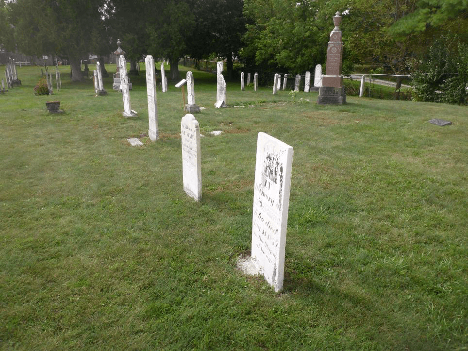
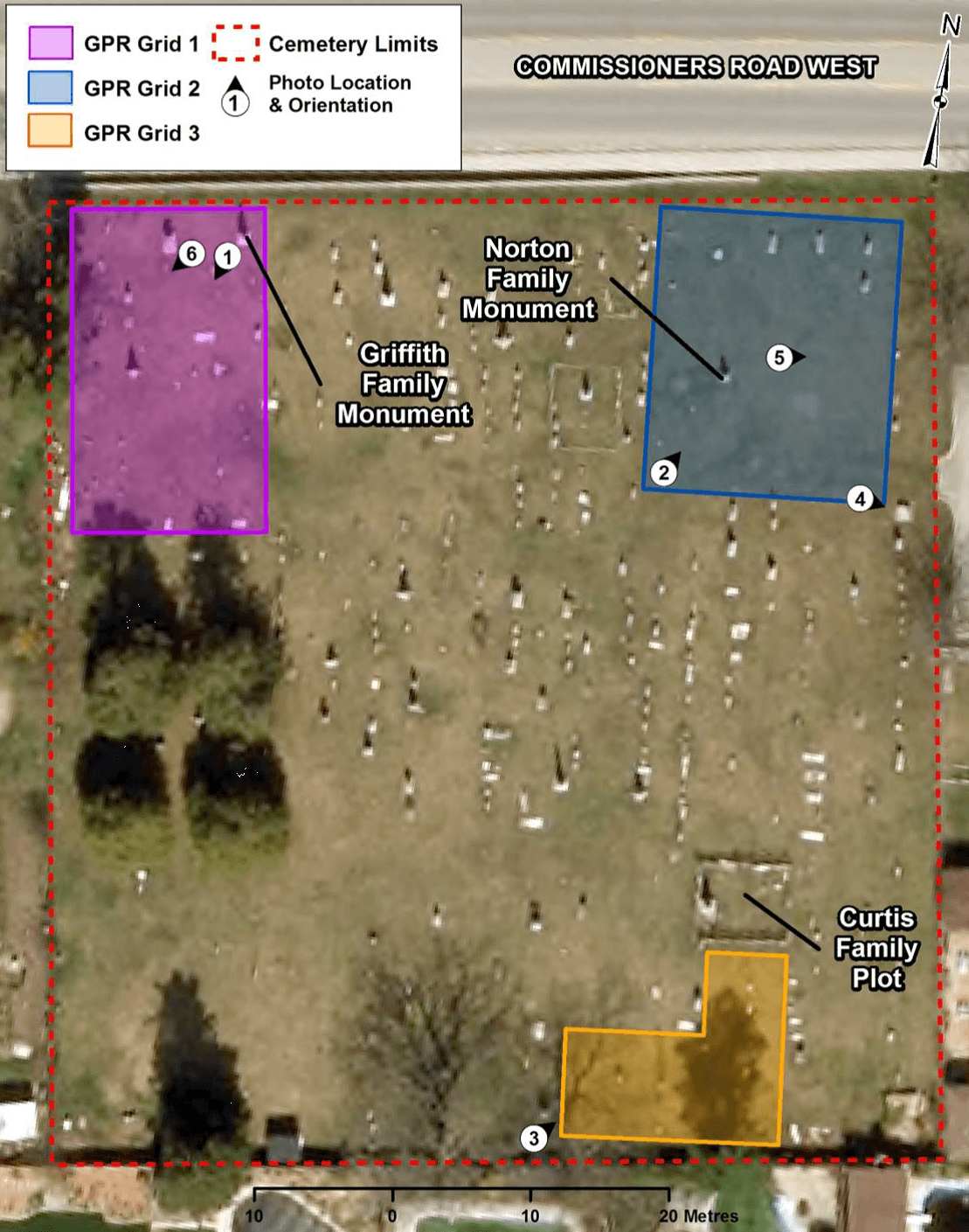
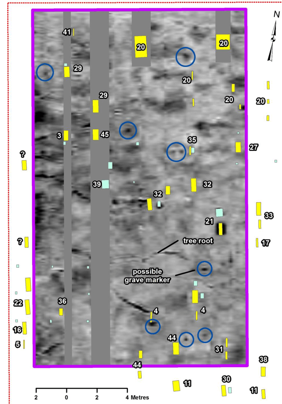
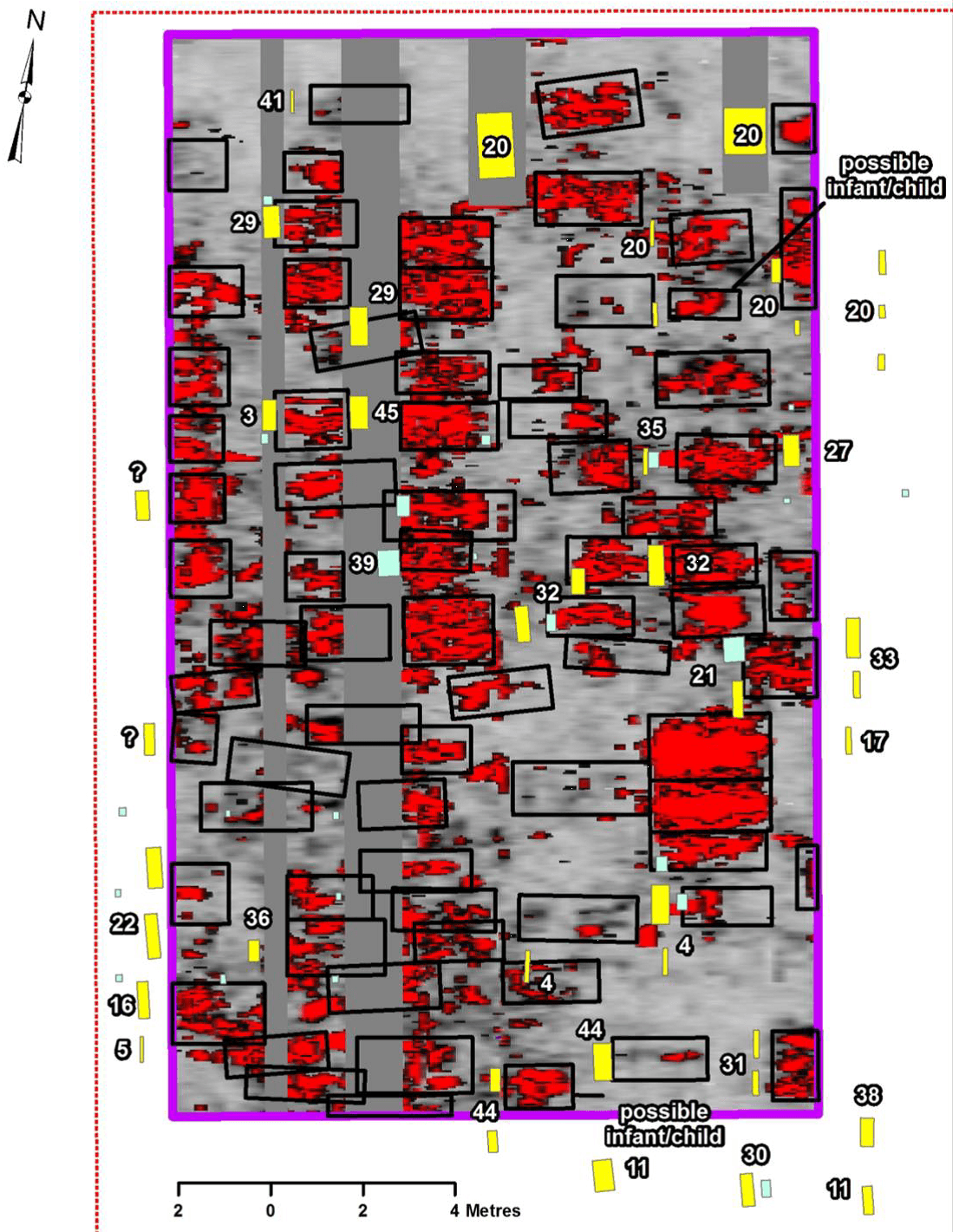
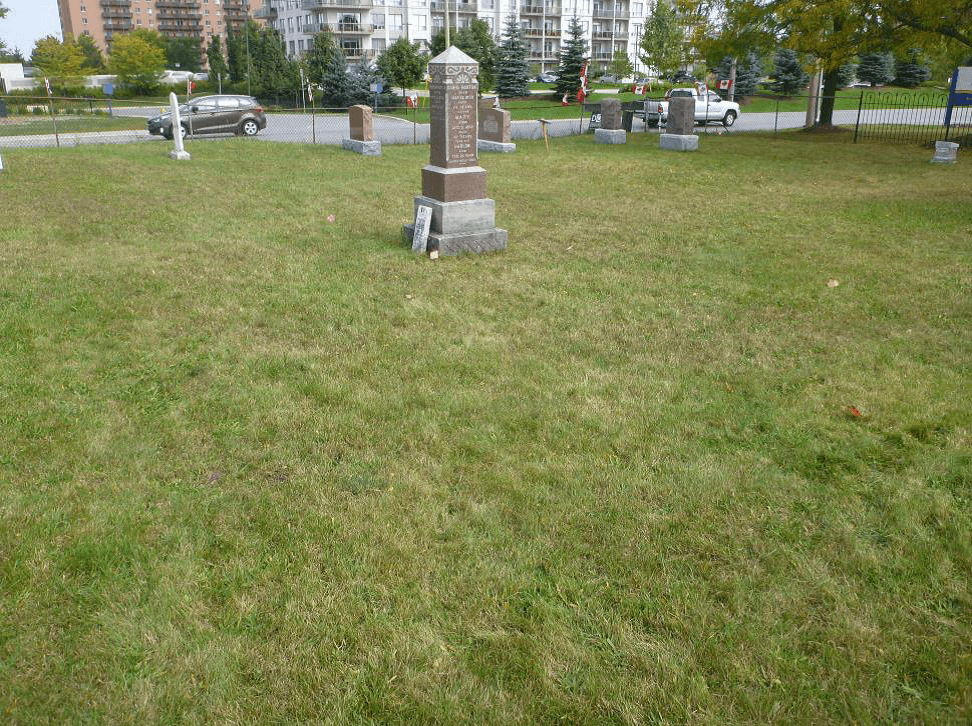
In 2015, TMHC conducted GPR investigations on several areas of Brick Street Cemetery. The Griffith plots were located in the northwest corner of the cemetery containing two Griffith family monuments situated in the north end of the survey grid.
The data depicts at least eight possible grave markers buried near the ground surface. Only one possible marker was observed near the survey grid’s west boundary because visibility was significantly obscured by the sprawling roots of nearby trees.
At least 74 grave shafts were observed between 50 and 175 cm below the surface. All grave shafts are oriented east-west, with headstones facing east, in keeping with Christian tradition.
Brick Street Cemetery – 2015 Survey: Dale Section

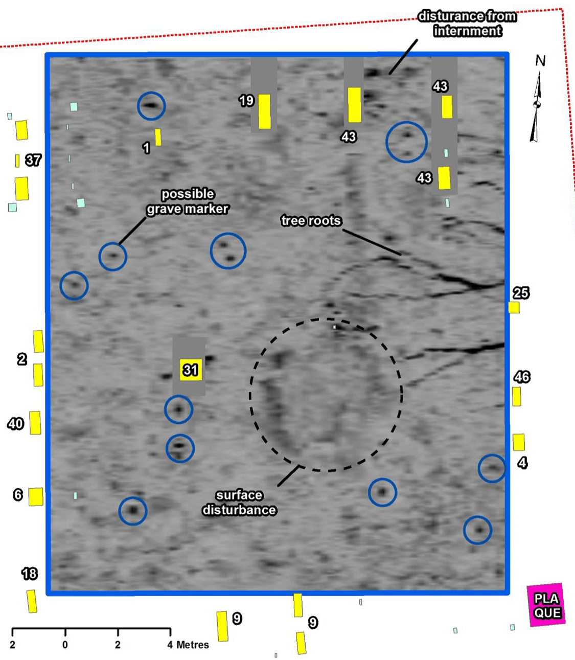
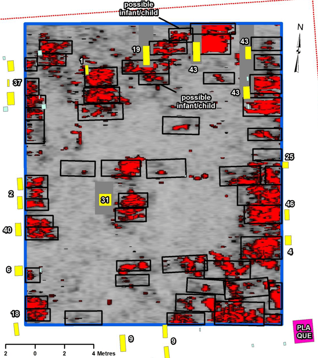
The second area surveyed in 2015 was established in the northeast corner of the cemetery containing the Dale family monument at its approximate center.
The data depicts sprawling tree roots in the east half of the survey grid, surface disturbance at its approximate centre, some shallow disturbance from interments throughout the grid, and several possible buried grave markers. The latter was observed throughout the survey grid, however some of these may actually be rocks or small cobbles.
At least 54 grave shaft features were observed between 70 and 180 cm below surface. Most of these can be identified as single graves however those along the grid’s southeast corner are tightly packed and displace relatively strong reflections making individuation between graves extremely difficult. In general, bodies are oriented east-west.
Brick Street Cemetery – 2015 Survey: S.E. Section
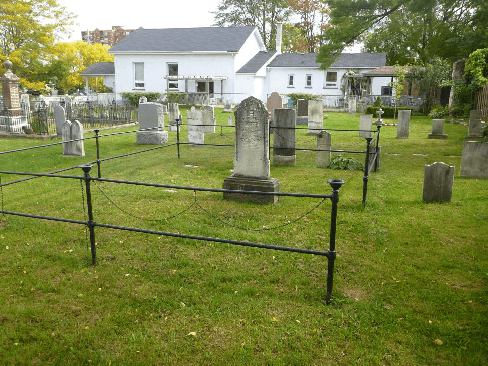

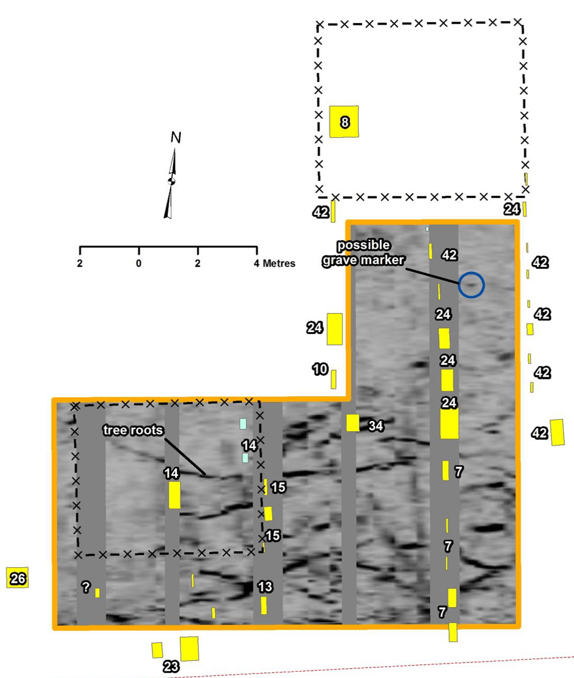
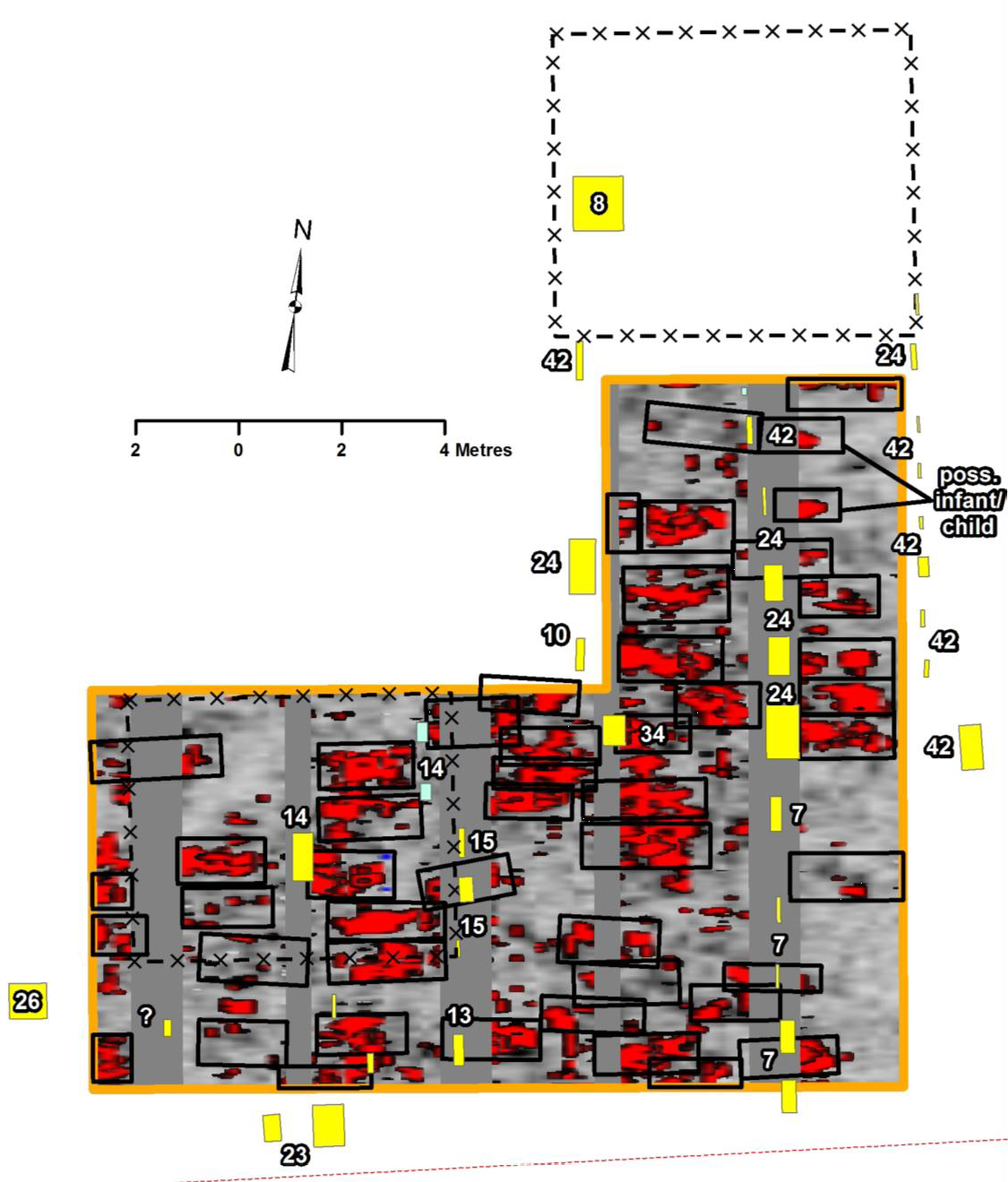
The SE Section was immediately south of the enclosed Curtis family plot in the southeast portion of the Brick Street Cemetery.
The data depicts lots of disturbance relating to the sprawling roots of nearby trees. Only one possible grave marker was identified near the northeast corner of the survey grid.
At least 48 grave shaft features were observed between 75 and 150 cm below the surface. All are oriented east to west and most are likely adults.
TMHC’s relationship with the Friend’s of the Brick Street Cemetery is ongoing as there are still areas of the cemetery that would benefit from GPR survey. In the coming years we hope to return to Brick Street and continue learning about this important London, Ontario landmark.
For more information about Ground Penetrating Radar and how this TMHC service might work for you contact: info@tmhc.ca
Or check out our Cemetery and Burial Investigation Services page
To learn more about the Brick Street Cemetery, check out the Friends of the Brick Street Cemetery’s Facebook Page and the Brick Street Cemetery Website.
